Where Is Zion?
Explore More in Zion National Park
Directions To Zion Park
Zion National Park Location and Entrances
Where is Zion National Park?
How to get to Zion National Park?
Where are the entrances to Zion National Park?


How to Get to Zion National Park – from Utah, Nevada, Arizona, Colorado.
Las Vegas, Nevada
Getting to Zion National Park From Las Vegas, Nevada or St. George, Utah
Estimated Drive Time: About 2.5 to 3 hours.
Directions:
Take I-15 North from Las Vegas.
Continue on I-15 North for about 130 miles.
You'll pass through St. George, Utah along the way
Take Exit 16 for UT-9 East toward Hurricane/Zion National Park.
Follow UT-9 East for about 33 miles, passing through La Verkin and Virgin.
Continue on UT-9 to the park entrance in Springdale.
Salt Lake City, Utah
Getting to Zion National Park From Salt Lake City, Utah
Estimated Drive Time: About 4.5 to 5 hours.
Directions:
Take I-15 South from Salt Lake City.
Continue on I-15 South for about 260 miles.
Take Exit 16 for UT-9 East toward Hurricane/Zion National Park.
Follow UT-9 East for about 33 miles, passing through La Verkin and Virgin.
Continue on UT-9 to the park entrance in Springdale.
St. George, Utah
Getting to Zion National Park From Northern Arizona (e.g., Page, AZ)
Continue on US-89 North until you reach Kanab, UT.
From Kanab, take US-89 Alt North toward Zion National Park.
At Mount Carmel Junction, turn left onto UT-9 West.
Continue on UT-9 West to the park entrance.
Getting to Zion National Park From Colorado
Take I-70 West from Grand Junction.
Continue on I-70 West to UT-24 South in Green River.
Take UT-24 South to UT-62 West.
Take UT-62 West to UT-22 South.
Take UT-22 South to US-89 South.
From US-89 South, turn right onto UT-9 West at Mount Carmel Junction.
Continue on UT-9 West to the park entrance.
What are the access points to go into Zion National Park?
Main Canyon - From Springdale, Utah (south Entrance)
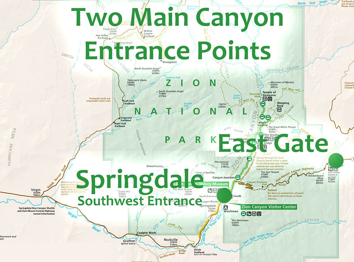
Location: Springdale is situated directly at the main entrance to Zion National Park and access is to the lower section of the park.
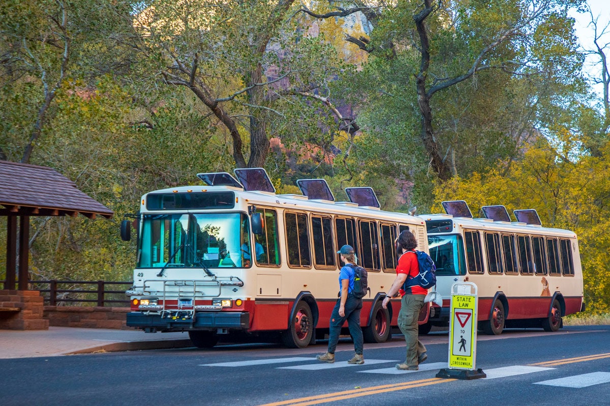
What You'll Find: The South Entrance is the main gateway to Zion. It provides access to the Zion Canyon Visitor Center, shuttle bus system (operational seasonally), and Zion Canyon Scenic Drive.
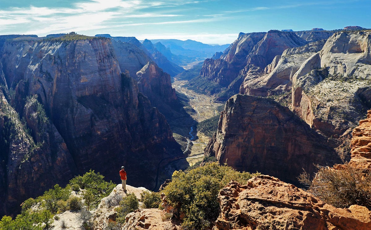
Benefits: Ideal for visitors planning to explore the main canyon, hike popular trails like Angels Landing and The Narrows, and access park amenities and services.


Main Canyons - From the East Gate of the Park (east Entrance)
Location: The East Entrance is accessed via UT-9 West, coming from Mount Carmel Junction, and access is to the main canyon in the lower section of the park.
What You'll Find: This entrance provides a scenic drive through the Zion-Mount Carmel Highway, featuring the Zion-Mount Carmel Tunnel, Checkerboard Mesa, and other stunning rock formations.
Benefits: Offers a less crowded entrance, providing a picturesque introduction to the park. Ideal for visitors coming from Bryce Canyon or Grand Staircase-Escalante.
Kolob Terrace - From the town of Virgin, Utah (Mid-section)
Location: Virgin is located to the southwest of Zion National Park.
Access is to the Kolob Terrace Road north. This road leads directly into the less-visited Kolob Terrace section of Zion National Park.
Description: As you ascend, you'll pass by several points of interest, including Lava Point, one of the highest elevations in the park, and the starting point for the West Rim Trail. The road offers access to many trailheads and scenic overlooks, providing a more remote and serene experience compared to the main Zion Canyon. The upper section of this road (approx. last third) is closed in winter, but the lower two-thirds are still scenically beautiful in winter months. Check road conditions before driving.
What You'll Find: This area includes Lava Point, the West Rim Trail, and the backcountry permits office. It’s a more remote and less developed section of the park.
Benefits: Perfect for those seeking solitude and backcountry adventures. Offers access to less-traveled trails and stunning vistas.

Kolob Canyons (Kolob Fingers Northwest Section)
From Interstate 15:
Location: The Kolob Canyons entrance is located off I-15, approximately 40 miles north of St. George, Utah, and offers connection to just this section of Zion National Park.
Access: Take I-15 to Exit 40 (Kolob Canyons Road).
Exit the interstate and follow the signs to the Kolob Canyons Visitor Center, where you can obtain park information and permits.
From the Visitor Center, Kolob Canyons Road extends into the park, providing access to several trailheads and viewpoints, including the Timber Creek Overlook Trail and the La Verkin Creek Trail, which leads to the Kolob Arch. This is a five-mile route which you will return on this same road to Interstate Fifteen (I-15).
What You'll Find: This entrance provides access to the Kolob Canyons Visitor Center, Taylor Creek Trail, and Kolob Arch, one of the world’s largest freestanding arches.
Benefits: Great for visitors traveling on I-15 who want a quick detour to see the park’s stunning red rock canyons. Offers shorter, scenic hikes and less-crowded experiences.
How big is Utah's Zion National Park?
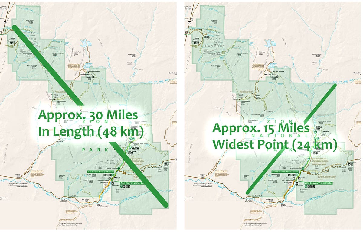
Zion National Park spans approximately 229 square miles, with its dimensions stretching about 15 miles from east to west and roughly 30 miles from north to south. The park's elevations range dramatically from around 3,666 feet at Coalpits Wash to 8,726 feet at Horse Ranch Mountain. This variation in elevation contributes to the park's diverse ecosystems and breathtaking landscapes.
Zion is carved from the Colorado Plateau, a geological region known for its high elevation and remarkable rock formations. The plateau's sedimentary layers, primarily composed of sandstone, have been sculpted over millions of years by the Virgin River, resulting in the park's iconic canyons, cliffs, and mesas. The combination of these geological features creates the stunning landscape we all enjoy today.