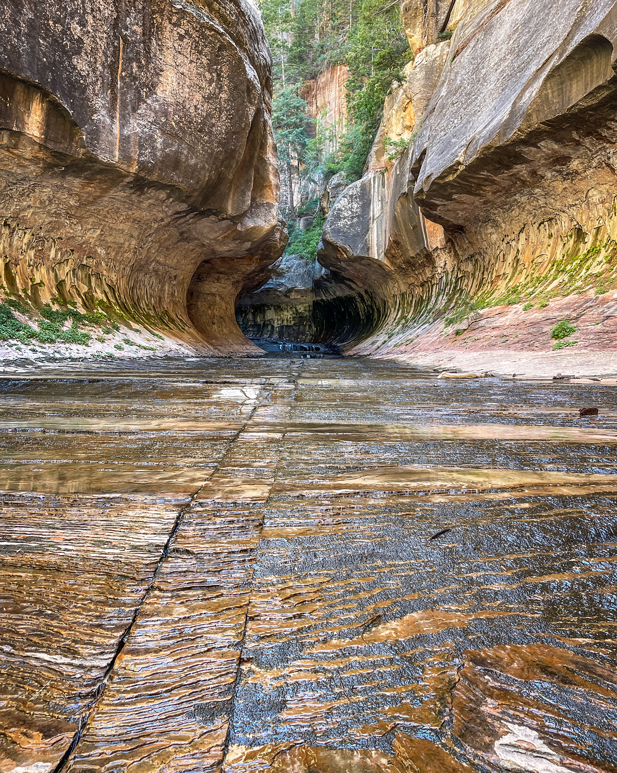
The Subway
Trail Length: 9.5 point-to-point or 9 miles out-and-back
Degree of Difficulty: Strenuous
Elevation Change: 1,300 feet
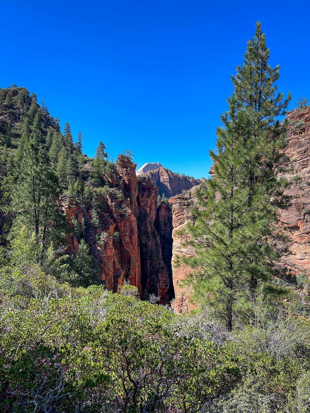
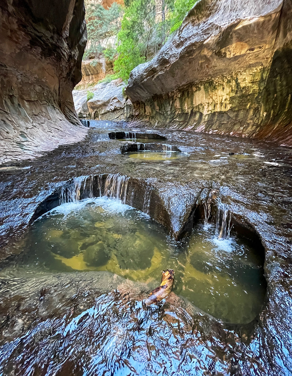
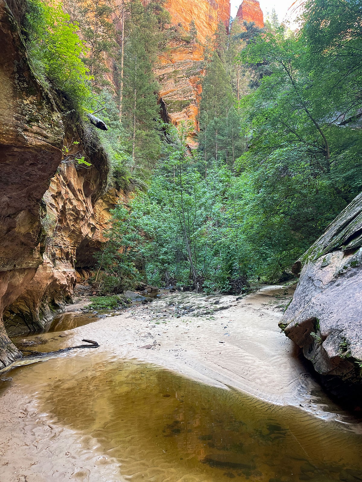
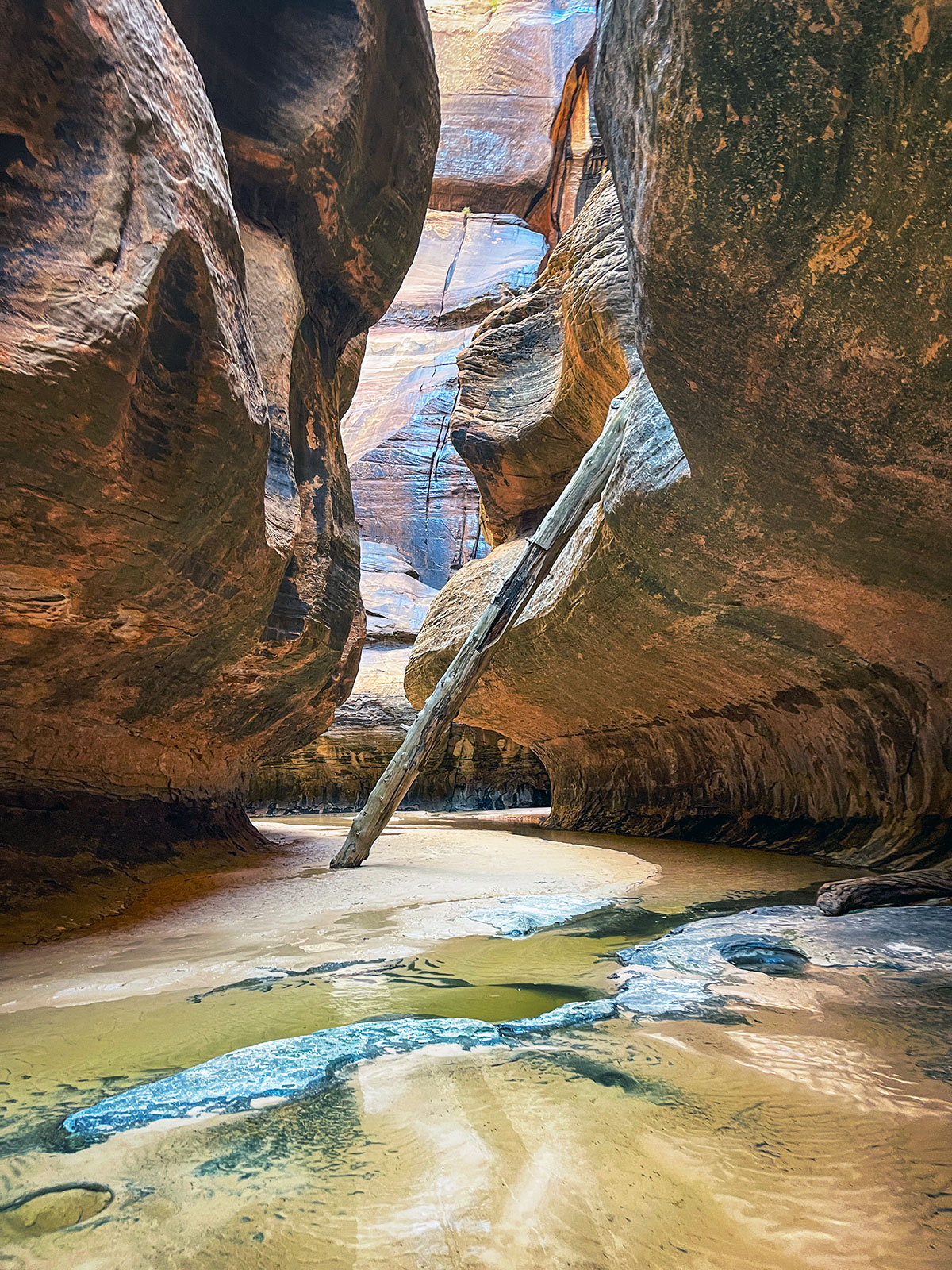
Hiking The Subway in Zion National Park is an incredibly unique experience in a one of a kind location, though challenging, it remains a Zion National Park favorite for a myriad of reasons. This special place gets its name from the tube like canyon walls that resemble an underground subway system. The terrain you can expect is wide ranged including: forest, sandstone canyon walls, obstacle navigation, water, and narrow slot canyons. This is a technical hike and requires a permit. Preparation and knowledge of the area and conditions is essential for a successful and safe time at the Subway in Zion National Park.
Tip: It is most difficult to hike from the bottom up and this hike should only be done with an experience canyoneer. In the heat of the summer it is recommended to bring 4L of water. Preserve some energy for the final climb out.
More about the subway
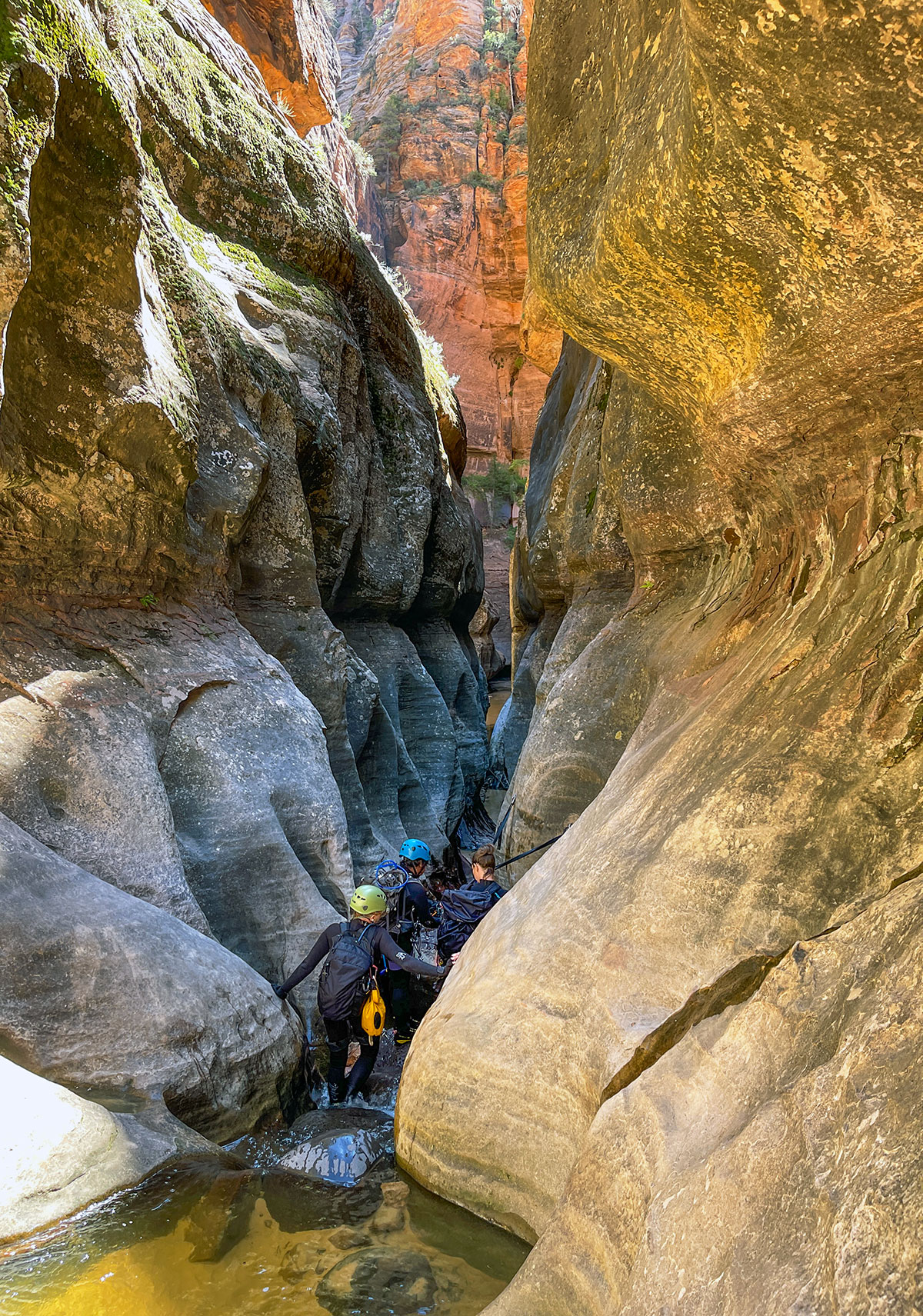
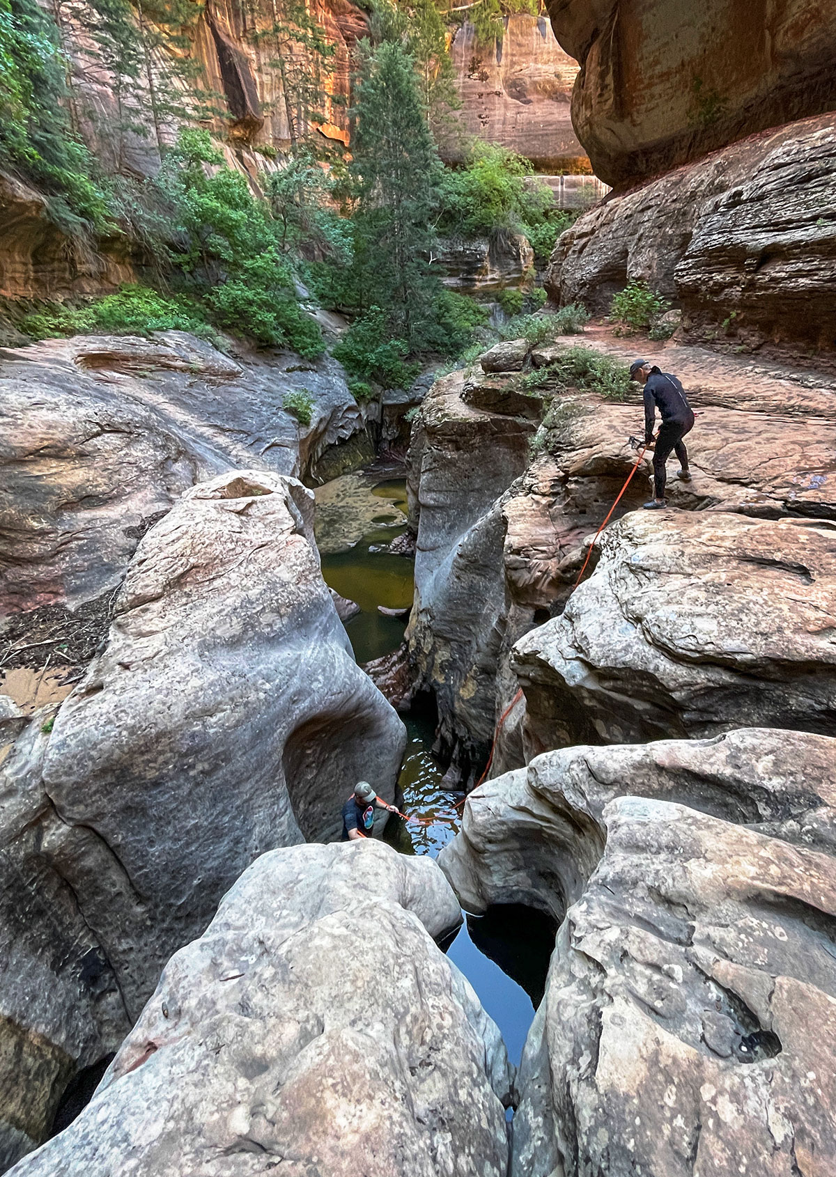
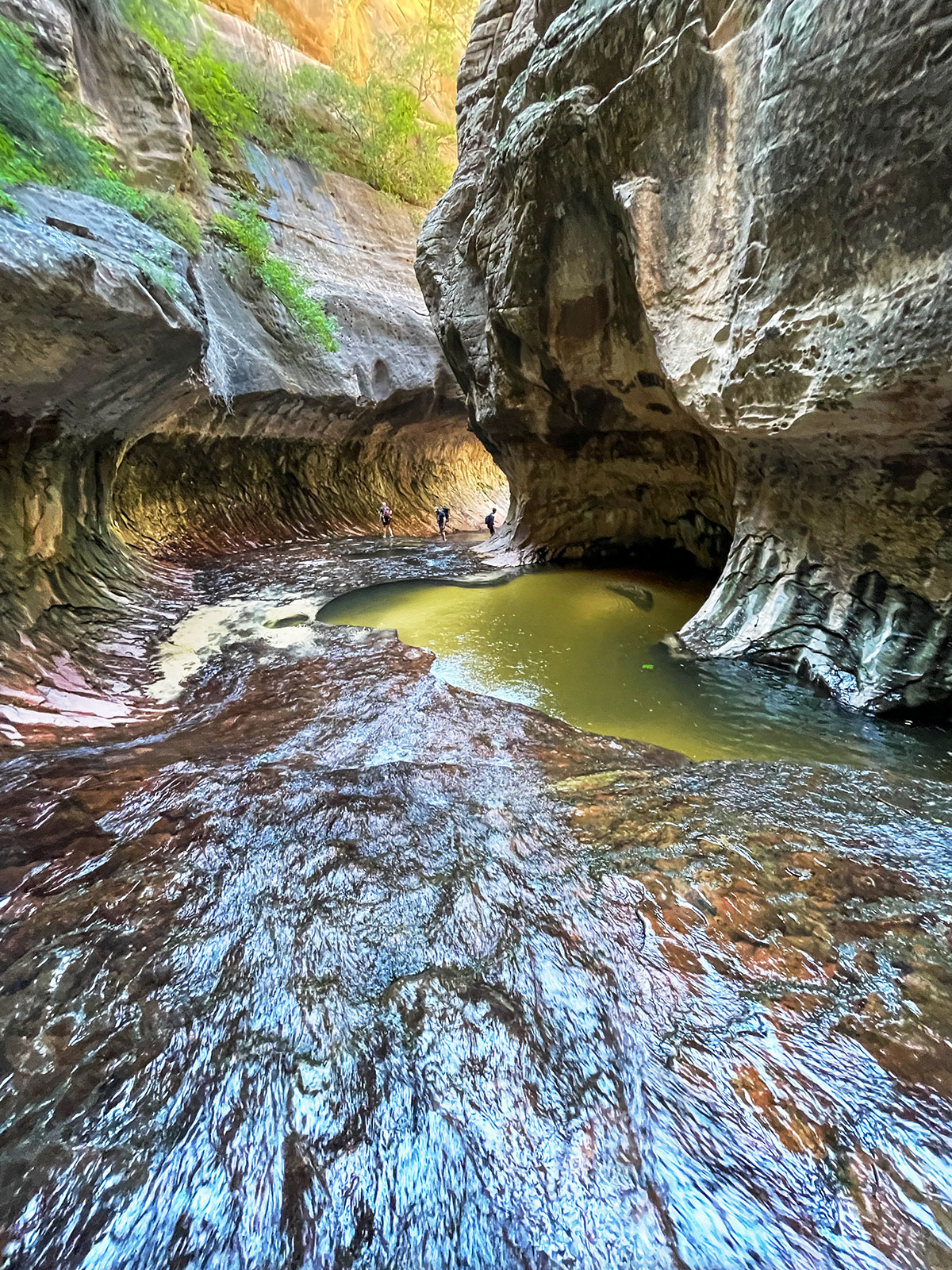
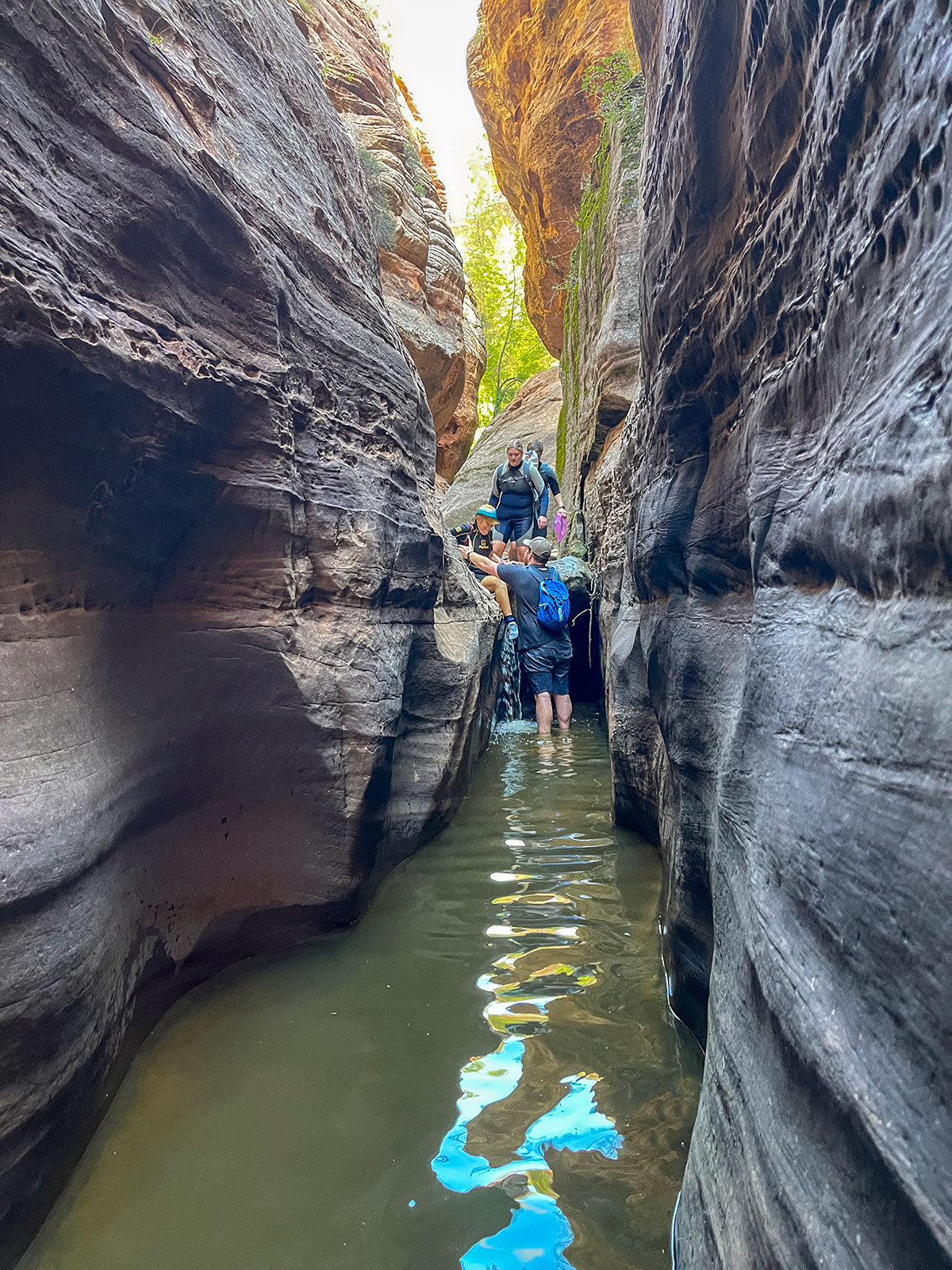
Subway Top-down
This version definitely the sought after adventurous choice as the route includes waterfalls, “rooms” formed by water, rappelling 30ft into a pool of water, wading through pools of water, several rappels and scrambling over and maybe even swimming under obstacles.
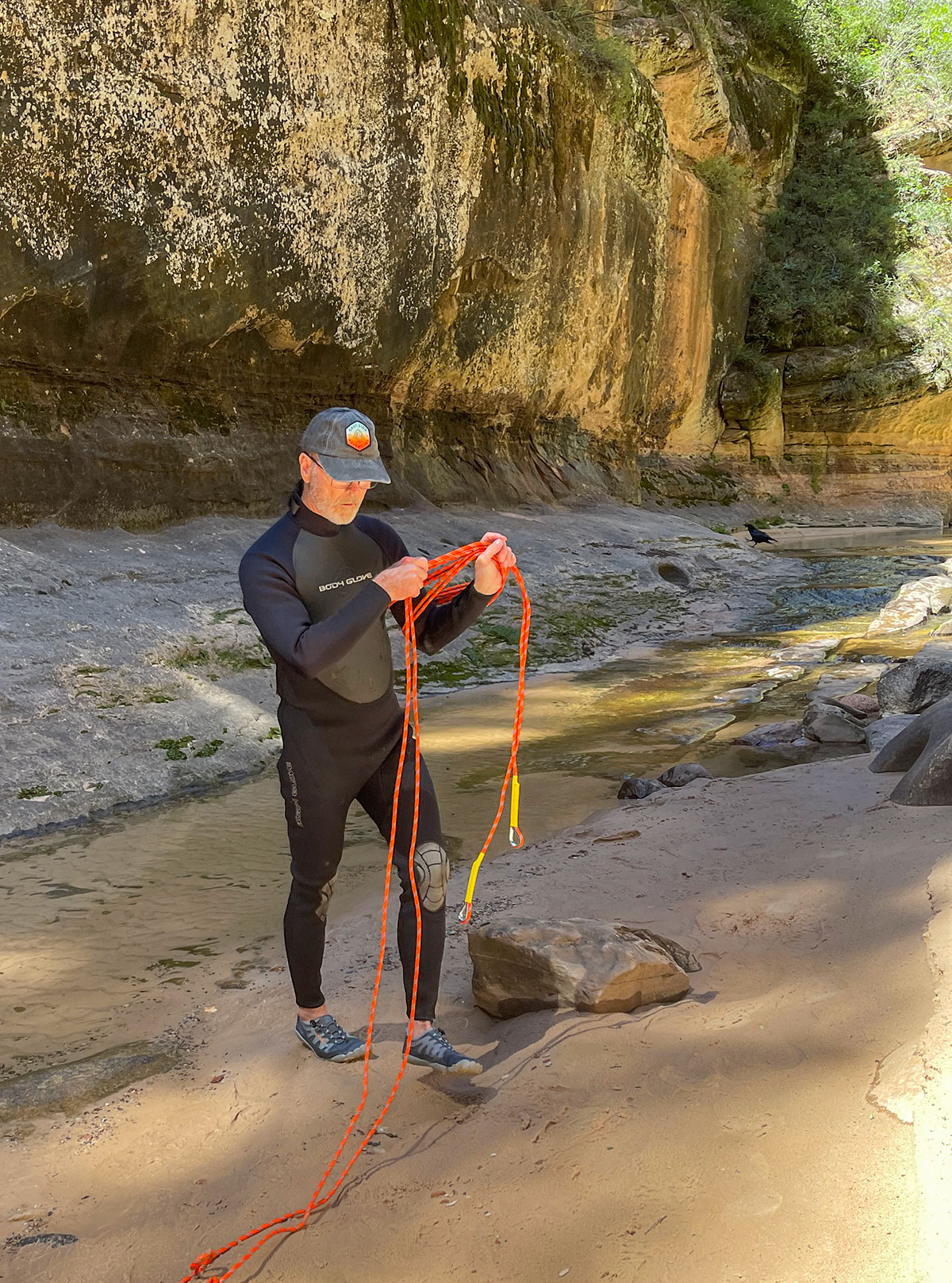
The Subway ACA rating is 3B III because it is intermediate canyoneering with rope required rappelling, takes most of a day to complete, requires swimming in water and recommendation for a wetsuit. It is also critical to have navigation skills as missing an exit can be dangerous. Only consider this version if you are well prepared and have the necessary canyoneering skills.
If you intend to hike top-down be sure you are well prepared in navigation, canyoneering equipment (harness, rappel device, helmet, ropes ect...), and all other advanced hiking and water navigation essentials.
Subway Bottom-up
Preparation
Preparation is essential for safely experiencing and navigating the Subway. It's important to be in the appropriate physical condition and have the necessary skills and equipment for whichever version you choose. It is important to do research, know the trail, have the proper navigational equipment and maps. Rain can have great impact in the Zion area and it is very important to know and be prepared for weather conditions. Always check with the park rangers for the latest information and updates before embarking on your journey.
Tips and supplies:
- Bring a wetsuit, dry bag, neoprene socks, and consider renting water boots.
- Bring plenty of food and water.
- Consider a first aid kit and sun protection,
- Study the trail - make paper notes, download maps.
- Have the proper rope experience or take a rappelling class.
- Visit May-September to avoid spring runoff and the cold/ice of winter.
- Avoid ankle injury by ensuring foot placement.
- Get an early start and allow plenty of time to complete this full day experience.
- Know the weather and check it regularly - do not do if there is a threat of rain.
- Let someone know hiking plans and expected return time.
- Pay attention to trail markers, signs, and cairns.
Permits
Permits are required year-round and for both top-down and bottom-up. These permits are to protect the area and ensure visitor safety. Permits are awarded in a variety of ways with lottery permits awarded in advance on varying schedules and the remaining allotted as walk-in permits. Check out the Subway - Zion National Park for more detailed information on the permit process and availability.
Getting to the subway
Bottom-up from Left Fork Trailhead is about a 20 mile / 30 minute drive from the Visitor Center in Springdale. Parking is limited with space for about 25 cars, during peak season it is important to arrive early.
Top-down requires a private car drop off or shuttle reservation.

